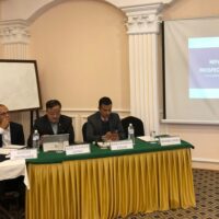
Two specialists from the US Department of Agriculture (USDA) led a weeklong workshop on how to effectively map the spread of diseases, like avian influenza, using Global Positioning Systems (GPS) and Geographic Information Systems (GIS) from January 20 to 24.
These cutting-edge technologies can help determine how diseases spread within a country, which makes programmes to combat diseases more effective, the US embassy in Kathmandu said in a press note. “The programme was attended by twenty Nepali veterinarians, scientists and other specialists working on issues related to the spread of diseases.”
The workshop was also supported by the Food and Agriculture Organisation’s (FAO) Regional Support Unit in Kathmandu.